Tuesday, March 18, 2008

Going home


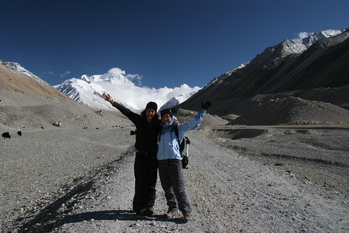
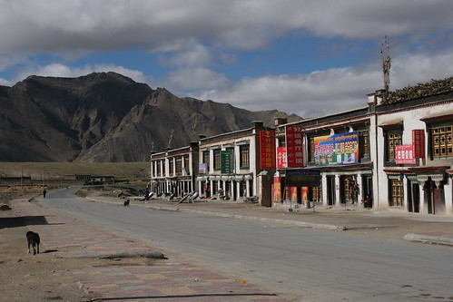
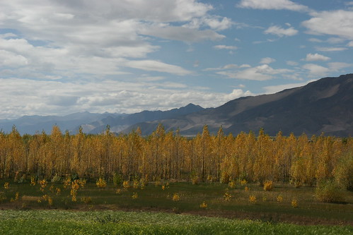
It’s been exactly a year since I left home in October 2006 and I’m nervous about going back. Someone asked me if I’d like to continue on but I don’t think I do. The novelty and thrill of seeing new places, and meeting new people every day has taken its toll. I'm longing for something unchanging. My anxieties verge from the predictable like ‘will I get a job?’ to the more complex ‘am I going to have a problem integrating into society again?’ I’ve already received emails asking if I’m back yet. This heightens my anxiety.

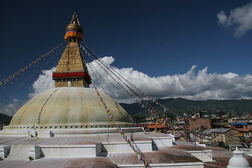
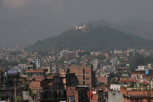
The last day. I’m up at 6.30 to pack. I’ve been looking forward to the day when I can throw away all my toiletries and it's today! I’m hoping this will help to make my bag lighter. Incomprehensibly it doesn’t. My backpack still weighs in at 24 kilos as it has done the whole trip. On the taxi ride to the airport I take my last glimpses of travel for a while.

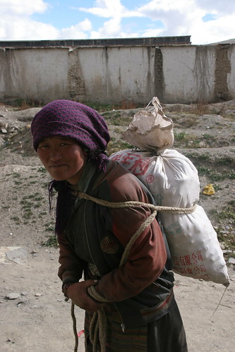
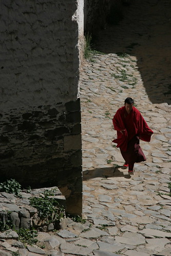
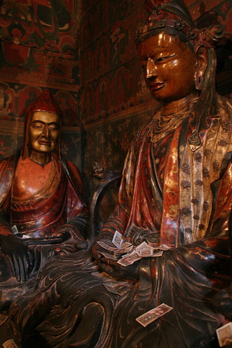
As I fly from Kathmandu to Bangkok, I think about the questions I’ll be asked apart from ‘Where was your favourite place?’ Questions like what have I learnt from my year away? Do I now know what I want from life? No, I don’t think so. I haven’t had time to think ‘deeply’. I didn’t realise travelling would be so exhausting. There are basic decisions to make every day so there hasn’t been much time for anything more profound. 'Have I ‘discovered’ myself' is another question I dread. In some ways I have. I understand my limitations better. I know that I’ll cope with most things life throws my way. I’ve learnt it feels good to challenge and overcome my fears. Above all I’ve realised I am lucky to have choices in life. Many of the people I’ve met in the past year don’t have a choice. They’ve been forced into a way of life because of circumstance. This is something I am truly grateful for. Whether things turn out the way I want or not, there are decisions I can make.

In Bangkok my plane is delayed by two hours to 2am. I kill time by eating a red curry and having a massage. My last indulgence. I’ll be home in 11 hours. I feel strange. The past year has already started to fade…

Bodhnath, Kathmandu, Nepal


I first started to think about going home a week ago, part of me excited about seeing familiar things again, and part of me wishing I could continue my adventure. The truth is that for the last four months I’ve been exhausted. I have one more day in Kathmandu before I begin the long journey home.

I have a terrible hangover this morning so even after a breakfast of banana pancakes and creamy masala tea I resort to ibuprofen to take the pain away.

I decide to visit Bodhnath (Boudhanath), 5 kilometres east of Kathmandu, a Tibetan community of restaurants shops and monasteries surrounding a huge golden stupa, the largest in Nepal and one of the largest in the world. It’s a little piece of Tibet, away from the bustling streets of central Kathmandu.

Kathmandu, Nepal


Kathmandu is like an old friend. It doesn’t shock me or repel me as it did when I first arrived. I am pleasantly surprised to find my valuables are still in the hotel safe after being away for two weeks. I’ve heard many stories of items going missing.

It’s our last night as a tour group so we hit the ‘Roadhouse’ in what we’ve dubbed ‘restaurant alley’. I have a cocktail to celebrate our last night but since I haven’t touched alcohol for weeks it goes straight to my head.

The road to Kathmandu


The road to Kathmandu


Crossing the border


Zhangmu, Tibet


We arrive into the chaotic border town of Zhangmu at 8.30pm, brought to a standstill by gridlocked roads of trucks waiting to cross into Nepal. We’ve gone from 5000 metres to 2300 metres in the matter of a few hours.

I’m looking forward to laying down my head but the paper-thin walls and windows are no match for slamming doors and disco music. At 9am we join a messy crowd of people at Chinese immigration. Among the crowd are some hardcore climbers with beards, ruddy cheeks and frostbitten noses. The classic explorer stereotype. Many of the voices are British. I overhear one conversation:

- ‘I’m going home but then coming back to climb K2’
- ‘Have you climbed Everest?’
- ‘Many times’

I’m so impressed that I strain to hear more of the conversation. I learn he’s a guide and lost a toe on one of his expeditions. His aim is to climb every mountain in the Annapurna range. I’m really impressed.

Eventually I’m called inside where my details are hand-typed on to a computer but the x-ray machine is broken so our luggage isn’t checked. We’re still eight kilometres from the Nepali border and there are queues of trucks all the way. It’s chaos. Even though it’s raining heavily and the road is one of the roughest I’ve driven on, the views are still stunning: sweeping gorges and waterfalls around every corner. We close our windows as we pass waterfall after waterfall thundering down on to the road.

Our land cruisers finally drop us off at the border. We have a 500-kilometre walk with our backpacks in the mud and rain across the Friendship Bridge and down the hill to the Nepali immigration office. Immigration is just as chaotic on the Nepali side but it seems less regimented than in Tibet. It’s then a three-hour drive through verdant landscape back to Kathmandu.

Sunday, March 09, 2008

The road to Zhangmu


Nyalam is a one-street town jammed with cars queuing to cross into Nepal. It’s a construction site during the day which means vehicles have been amassing ready for the border opening at 6.30pm.

Once the border opens, hundreds of vehicles start to descend from the Tibetan plateau into a mossy gorge studded with endless waterfalls. It’s a shocking transformation of landscape. We’ve gone from dry, sunny with sparse vegetation to wet, misty and waterlogged in the space of a couple of hours. Although this is still The Friendship Highway the road is nothing more than a mud track, under construction apparently, to be ready for the Beijing Olympics. I can’t see this happening. In the land cruiser we’re thrown around like rag dolls, and unable to see anything in the sea of fog.

‘Nyalam’ means ‘gateway to hell’ in Tibetan. I feel like I’m descending into the bowels of the earth. Despite the deluge, the descent to Zhangmu is stunning. It feels like a lost world. Following a winding mountain path we pass under waterfalls, towering green cliffs, past lush vegetation and across raging rivers. I feel I could be in Venezuela or Vietnam.

Tingri, Tibet


Tibetan Plateau


It’s a very bumpy 3-hour drive on a yak track to Tingri, a small town overlooking a sweeping plain bordered by towering Himalayan peaks. Some people hike from Base Camp to Tingri in 3-4 days. It doesn’t look easy.

After a lunch of vegetable curry and rice, we’re racing across the Tibetan plateau again to Nyalam, a checkpoint town 30 kilometres from the Nepali border. The landscapes are some of the most beautiful I’ve seen – sweeping plains, snowy peaks and endless blue skies. I’ve run out of superlatives to describe them.

On the way to Nyalam we drive through our final pass – the Nyalam-Tongla Pass - at 5120 metres.

Rongphu Monastery, Tibet


As the cloud doesn’t look like clearing any time soon we decide to leave for the border at Zhangmu, a 9-hour drive over rugged terrain.

As we leave Everest Base Camp we stop briefly at Rongphu Monastery located 7 kilometres from the camp. Famous for being the highest monastery in the world, it was once home to 500 monks and nuns. It now has 11. Small and compact compared to the giant complexes I’ve recently seen, it couldn’t have a more stunning backdrop. Everest looms in the distance like an exquisite painting.

Everest Base Camp, Tibet


I do not sleep well. Even though I’d put on my thermals, hat, scarf, gloves and buried myself under two duvets, I was still freezing. It was minus 5 I suppose. Not only that but the light was on all night as no one could work out how to switch it off, and I dreamt again that my camera was stolen, an anxiety dream I keep having. At 7am I need to pee but I can face the smelly long drop toilets. It’s still dark outside and now snowing so I put on my hiking boots, take my trusted maglite and find a land cruiser to perch behind. I bump into several others with the same idea.

As the morning light draws in, the group start walking up to Base Camp. I’m exhausted and my whole body aches so I and Connie take the cart. I don’t feel guilty.

When we arrive it’s overcast and Everest is covered. I feel a pang of relief although it’s disappointing for the others who didn’t see it yesterday. Everest can barely be seen under the swathe of cloud.

Everest Base Camp, Tibet


It’s 6.30pm and it’s taken us 1.5 hours to arrive at the checkpoint where we need to show our passports. I feel exhilarated. The final challenge is a short steep climb up a hill festooned with prayer flags, This is the ultimate viewing spot. It’s bitterly cold and windy but the views of Everest are awe-inspiring. There is a tiny cloud cap covering the summit, otherwise the views are of blue skies and brilliant white snow.

Behind the hill is a plain from which Everest rises majestically to 8850 metres. During the months of May, June and July this area is apparently crawling with the tents of expedition groups. There are none now and venturing into this area without a guide could land you with a hefty fine. Clouds are starting to creep across the plain and the light starts to fade quickly so we catch donkey cart back down the hill for 25 Yuan (about £1.75). By the time I’ve reached the tent I can’t feel my hands at all.

(Photo - Everest from Base Camp)

Everest Base Camp, Tibet


Nearly there... Connie and I on the last leg

Everest Base Camp, Tibet


The walk to Base Camp

Everest Base Camp, Tibet


It’s 5pm when we arrive and although our (exhausted) group is due to walk the 4 kilometres up to the official Base Camp early tomorrow morning I’m keen to take advantage of the clear bright weather. To be completely honest I’m paranoid and would be gutted if I’d come all this way only to see Everest shrouded in cloud.

As one of the girls and I walk start walking along the flat rocky path, we’re overtaken by jangling donkey carts ferrying passengers under blankets. I’m tempted to join the lazy tourist brigade but know I would be disappointed with myself.

After a while the flat road becomes an incline, steep in places, winding itself around rocky peaks. Everest is always obscured until the very end when a straight path opens up to reveal the mountain in full glory.

(Photo - carts overtaking us on the walk to Base Camp)

Everest Base Camp, Tibet


Everest Base Camp is a strange place. Situated at 5200 metres on the north face it was first used by the 1924 British Expedition. The ‘camp’ where non-climbers stay consists of a dirt road surrounded on both sides by a shabby collection of glorified tents, with names such as ‘Hotel California’ and ‘Snowland Hotel’, and sellers of tat. There is even a post office at the end of the track from where you can send an exorbitantly priced postcard.

Tashi Dzon (Peruche),Tibet


More winding roads lead to the village of Tashi Dzon or Peruche, where we break for vegetable noodle soup. We have been advised not to eat meat outside Lhasa. Everest Base Camp is a further three hours drive over rough ground.

Pang-la Pass, Tibet


Not long after Shegar we leave the Friendship Highway and join a dusty track which winds its way up to Pang-la Pass at 5120 metres. Here there are sweeping vistas of the Himalaya range including Makalu, Lhotse, Gyachung, Cho Oyu and Everest. I can see all of them apart from Everest which is obscured under a puffy cloud.

Drive to Everest, Tibet


I sleep well despite having to get up twice and pee into the ceramic basin provided under the bed. Having visited the 'hotel' toilets (a stinking wet short-long drop at the end of the corridor) earlier that evening it really was the best option. I also had a shocking dream about the Dalai Lama which I won't retell.

We're back on the Friendship Highway after breakfast heading towards Everest Base Camp. On the way we stop at Gyatsola Pass, which at 5248 metres, is the highest place I've ever been to. With a backdrop of snowy mountains it's picturesque spot but not a place to linger. The wind and cold are fierce battering the prayer flags into submission.

I continue my 4x4 journey through the Tibetan plateau, over potholed roads, scree and grass, passing icy snaking rivers and snowy peaks. The views are truly breathtaking.

At Shegar, a dusty one-horse town, we stop to collect our Everest passes.

Drive to Lhatse


For the few that may still be following this epic travelthon, I am now back in London and have been for a few months (will come to that later). My year away has tragically been reduced to a few abiding memories and a stack of photo CDs which I haven't looked at yet. It's hard to believe that I managed to write this blog while on such a punishing travel schedule, and even harder to believe that five months later I ashamedly still haven't finished it. But this is what I aim to do, and despite a hazy memory I still have my journal with its messy scribblings.

Leaving the austere monastery of Sakya, we drive for an hour through an empty beguiling landscape to Lhatse, our home for the night.

Sunday, January 06, 2008

Sakya, Tibet


A local woman stops to talk to me as I walk around the monastery

Sakya Monastery, Tibet


Sakya is a three-hour drive from Shigatse across empty landscapes studded with the odd village. It's a small dusty town dominated by an austere brooding monastery. There are actually two monasteries: the northern monastery which is mostly reduced to ruins and the southern, a grim, forbidding fortress with thick grey walls. Only two chapels are open at the moment so I take the opportunity instead to walk around the monastery through piles of rubble.

One of the unusual things about the town is the colour of the buildings. Unlike the whitewashed houses seen elsewhere in Tibet, all the buildings are painted in grey with white and red vertical stripes. The colour symbolises the Risum Gonpo, the trinity of the bodhisattvas and marks Sakya authority.

Tashilhunpo Monastery, Shigatse, Tibet


Tashilhunpo Monastery, Shigatse, Tibet


Pilgrims leaving Tashilhunpo Monastery

Tashilhunpo Monastery, Shigatse, Tibet


A monk picking up offerings from pilgrims

Tashilhunpo Monastery, Shigatse, Tibet


Tomb of 10th Panchen Lama (Sisum Namgyer)

Tashilhunpo Monastery, Shigatse, Tibet


The highlight for me is the Tomb of the 10th Panchen Lama (Sisum Namgyel), Tibet's favourite Panchen Lama. A gold-plated chorten holds his remains while his image is surrounded by kaleidoscopic rainbow swirls. The photography fee in this chapel is 125 Yuan (about £9). When I approach the monk to pay he seems surprised.

Tashilhunpo Monastery, Shigatse, Tibet


Although there are hordes of pilgrims (and tourists) which makes queueing to enter chapels slightly unpleasant, Tashilhunpo is the first place I feel spiritually close to the Dalai and Panchen Lamas. I can't quite define the reason why but for this feeling I decide it's my favourite monastery. Although we have several hours here, it doesn't feel enough. There's a huge area to explore which would justify an extra day.

As I enter the Chapel of Jampa (Jamkhang Chenmo) I'm greeted first by a sign saying photography costs 75 Yuan (about £5). Behind the stream of pilgrims spooning yak butter into candle vats is the world's second largest Buddha. At 26 metres high it took 900 workers six years to complete. Covered in 300kg of gold and precious stones it's a formidable structure.

Tashilhunpo Monastery, Shigatse, Tibet


Tashilhunpo Monastery, Shigatse, Tibet

Tashilhunpo Monastery, Shigatse, Tibet


The huge monastery is a walled town in its own right. Its cobbled lanes throng with the murmur of pilgrims queueing to enter the golden-topped ochre buildings containing the tombs of past Panchen Lamas. At its peak Tashilhunpo was home to 5000 monks. These days it houses around 600. Many of the monks here are English-speaking and said to be in cahoots with the Chinese authorities. We are warned not to say anything controversial inside or show pictures of the Dalai Lama.

Tashilhunpo Monastery, Shigatse, Tibet


Tashilhunpo is one of the six great Gelugpa monasteries along with Drepung, Sera and Ganden. Founded in 1447 by a disciple of Tsongkhapa, Genden Drup, who was retroactively named the first Dalai Lama. When the fifth Dalai Lama declared his teacher, then the abbot of Tashilhunpo, to be a manifestation of Opagme (a deification of the Buddha's faculty of cognition and perception), the monastery's importance rose and Tashilhunpo became the seat of the Panchen Lama. 'Panchen' literally means 'great scholar' while 'lama' means 'higher monk'.

Shigatse, Tibet


It's a two-hour bus ride to Shigatse, Tibet's second largest town. The big draw here is Tashilhunpo Monastery, the seat of Panchen Lama, although he actually lives in Beijing.

Shigatse reminds me of a smaller version of Lhasa: the same street sellers, shops and Tashi restaurants.

Gyantse, Tibet


View of Pelkor Chode Monastery and Gyantse Kumbum from the fort

Gyantse Dzong, Tibet


This 14th century fort looms over the town and the surrounding Nyang-chu Valley. It's a 20 minute walk up a snaking path plus a further hike up some very steep steps to reach the top. The views are worth the effort.

At the foot of Gyantse Dzong is the 'Memorial Hall of Anti British', a room filled with a warped account of the 1904 British invasion stating 'Tibet is an inalienable part of the motherland...' and how content the people are now that it's under communist rule.

Tuesday, January 01, 2008

Gyantse, Tibet


Gyantse Kumbum, Tibet


Gyantse Kumbum, Tibet


Gyantse Kumbum, Tibet


In the monastery complex is the famed Gyantse Kumbum, (kumbum means '100,000 images') the largest chorten in Tibet. Designed in layers as a three-dimensional mandala or model of the Buddhist universe, it has five levels (plus a 6th-floor viewing platform) which represent the five stages to enlightenment. The golden dome rises over four sets of eyes that gaze out in the directions of the cardinal points. A clockwise route leads pilgrims up dingy staircases to the next level. The chorten has 77 chapels in total, some containing well-preserved murals and buddhas, although many of them are dark.

Pelkor Chode Monastery, Gyantse, Tibet


Pelkor Chode Monastery, Gyantse, Tibet


Pelkor Chode Monastery, Gyantse Tibet


Pelkor Chode Monastery, Gyantse, Tibet


I'm in Gyantse to see the Pelkor Chode Monastery, founded in 1418, and which brought together three different orders of Buddhism in one place.

The assembly hall is dark but atmospheric with monk robes piled high on benches. The chapels adorned with various images of Buddha are thick with the smell of yak-butter candles.

Tibet


Drive to Gyantse, Tibet


Leaving Yamdrok-tso via the same road we drive to Gyantse, once again passing through the most dramatic landscapes.

Yamdrok-tso, Tibet


The road leads up to Kamba-la Pass at 4950 metres where there are dazzling views of the deep turquoise Yamdrok-tso lake. In the distance, the snow-capped Himalayas and the huge massif of Mount Nojin Kangstan (7191 metres) pierce the clouds. I've never seen mountains of this grandeur before.

Yamdrok-tso is a coiling scorpion-shaped body of water. Tibetan pilgrims circumambulate the sacred lake in seven days. Controversially the Chinese government wanted to utilise gravity to create a hydroelectric supply and by the mid-1980s had a agreed a plan to build a six-kilometre tunnel 10km below the surface of the lake that would send the waters dropping 846 metres into the Yarlung Tsangpo river. Work was temporarily halted after opposition from the Panchen Lama, but in 1997 the turbines had started generating electricity. The project is controversial not only because the lake is sacred to Tibetans, but because Yamdrok-tso is a dead lake with no outlet and no perennial source of water, which means that the water drained can never be replenished.

Leaving Lhasa


I spent last night in the hotel watching Tibetan TV, which more or less consists of fifty-odd channels shamelessly promoting the greatness of China, from incredible feats in surgery to engineering. I flick through the entire range several times amazed that there are no international news channels or English-speaking programmes.

I didn't sleep well last night but I'm revived by my new addiction: masala tea.

Today we're driving to Gyantse via Yamdrok-tso, one of Tibet's four holy lakes. As we leave Lhasa we travel though wide open landscapes of mountains, rivers and yellow trees, all resplendent under a bright cobalt-blue sky. Soon we climbing into scenery not unlike that of the Atlas Mountains.

Ganden Monastery, Tibet


Blue flowers

Kyi-chu Valley, Tibet


View from the high kora