Tuesday, July 31, 2007

McClean Falls, The Catlins, New Zealand


The walk to McClean Falls

McClean Falls, The Catlins, New Zealand


The Catlins is full of waterfalls and the first I visit is McClean Falls, at the end of a 20-minute trek through stunning ancient rainforest full of mosses and tree ferns.

(Photo - the walk to McClean Falls)

Porpoise Bay, The Catlins, New Zealand


Next door to Curio Bay is the perfectly curved Porpoise Bay, famous for Hector's Dolphins, the smallest Dolphin in the world which are only found in New Zealand waters. I don't see any but the crashing waves on the shore is eye candy enough.

Curio Bay, The Catlins, New Zealand


Triffid-like bull kelp on Curio Bay

Petrified Forest, Curio Bay, The Catlins, New Zealand


Petrified Forest on Curio Bay

Curio Bay, The Catlins, New Zealand


Huge ribbon seaweed washes up on Curio Bay

Monday, July 30, 2007

Curio Bay, The Catlins, New Zealand


Curio Bay is a small cove and location of an 160 million-year old petrified forest. Tree stumps and fallen logs from the Jurassic period covered by layers of rock and mud spread along the beach. Locals finding these ancient tree parts lent the bay its name. As interesting is the huge triffid-like seaweed (that I've since learnt is called bull kelp) several metres long strewn all along the shore.

Waipapa Point, The Catlins, New Zealand


My first stop is Waipapa Point where the last wooden lighthouse in New Zealand was built, three years after New Zealand's worst maritime disaster where the SS Tararina struck the jagged Otara Reef one kilometre offshore killing all but 21 of its 151 passengers.

The Catlins, New Zealand


On the way to the Catlins my bus travels first through Gore, a cowboy backwater and then Invercargill, a largest city by New Zealand standards of 50,000 people founded by Scottish settlers in the 1800s. The Lonely Planet gives Invercargill a bad rap and as soon as I arrive I can see why. It seems sparse and neglected but there's something else I can't quite put my finger on. 'Inbred' says the girl sitting next to me on the bus.

Soon after leaving Invercargill we enter the Catlins Coastal trail and begin travelling through farmland and gently rolling hills, and a dramatically different landscape to the towering mountain ranges of Fiordland.

Lake Manapouri, New Zealand


Sunset on Lake Manapouri

Lake Manapouri, New Zealand


The full beauty of the lake can be seen now the clouds have cleared. I'm still in awe of what I've seen today. Doubtful Sound will remain a magical place in my memory.

Hydroelectric power station, West Arm, Lake Manapouri


Everyone is silent on the way back over Wilmot Pass. I've had sensory overload again and am exhausted. Before crossing the now-clear Manapouri Lake we quickly visit to the hydroelectric power station on the shores of the lake. Driving 2 kilometres through a tunnel underground we arrive at the viewing platform overlooking what looks like a set from a James Bond film.

Doubtful Sound, New Zealand


Returning to Deep Cove

Doubtful Sound, New Zealand


Crooked Arm

Doubtful Sound, New Zealand


Crooked Arm

Doubtful Sound, New Zealand


Crooked Arm

Doubtful Sound, New Zealand


After reaching the Tasman sea where fur seals are cavorting on jagged rocks we cruise down the hauntingly beautiful Crooked Arm (which I misheard as Crocodile Arm) with its crystal-clear, still waters and incredible mirror reflections.

Hall Arm is almost as stunning and by the end of the three-hour boat trip I've taken close to 600 photos.

Doubtful Sound, New Zealand


Doubtful Sound, New Zealand


Doubtful Sound, New Zealand


I love the shapes of the mountains carved out by the glaciers

Doubtful Sound, New Zealand


Doubtful Sound, New Zealand


Doubtful Sound, New Zealand


Doubtful is the second largest of Fiordland's 14 sounds after Dusky Sound. Only Doubtful and Milford are easily accessible by road and/or boat.

Doubtful Sound, New Zealand


At Deep Cove I board the Patea Explorer, a vessel that can hold 160 people but there are only 23 of us today. Heading down Malaspina Reach, the main channel, I feel I'm at last in a remote wilderness, rugged and untouched. As the boat travels down the fjord I'm the only person on deck as the wind is ferocious. Every few minutes I need to come inside and defrost before heading out again.

Doubtful Sound, New Zealand


After an hour crossing Lake Manapouri we arrive at West Arm and board the bus over Wilmot Pass to Deep Cove. The bus crawls up the 670 metres to the top passing dense forest and ancient gnarly trees.

(Photo - Doubtful Sound from Wilmot's Pass)

Lake Manapouri, New Zealand


Land of the Long White Cloud

Lake Manapouri, New Zealand


Lake Manapouri is shrouded in mist and is said to be New Zealand's most beautiful and charming. The fifth largest lake in the country, it's dotted with small forested islands. The name Manapouri is thought to be an adaptation of Manawapouri which means sorrowful or anxious heart. Both this lake and Te Anau were gouged out by huge glaciers advancing to the sea. I can see why New Zealand was named 'Aotearoa' or 'Land of the Long White Cloud' by early Polynesian settlers. Long ribbons of white cloud float across lakes and mountains all over the South Island.

Fiordland, New Zealand


I'm visiting the more isolated Doubtful Sound, which can only be visited via a tour. Although it takes the same amount to time to reach as Milford Sound, the journey is more comples requiring a boat trip across Lake Manapouri and a bus through the 22km Wilmot Pass.

(Photo - pick up point for Doubtful Sound)

Milford Sound, New Zealand


Milford Sound, New Zealand


Milford Sound, New Zealand


I learn that Milford Sound is actually a fjord. The difference between fjords and sounds is that fjords are gouged out by the action of advancing and retreating glaciers over long periods of changing temperatures, carving the landscapes as they move. Sounds are created by land erosion.

By the time I arrive at Milford Sound it's 12.30 and the sun is high and glaring. It's not the brooding atmosphere I was hoping for. It must one of the few bright sunny days Milford Sound has seen.

Once through the terminal that's a bit like a mini-airport, and on board I head out past Mitre Peak, the famous landmark into the fjord. The sun is blinding and it's difficult to take photos that aren't completely washed out by the glare. Even though it's low season, several boats travelling down the fjord towards the Tasman Sea. The fjord is dramatic - high peaks, glacial-carved hills, countless waterfalls tumbling out of nowhere but I'm left slightly disappointed. This isn't the isolated, mysterious place I'd imagined. There are too many tourists for that, although I'm relieved I came when I did as I hear they have up to 80 tourist buses at a time here in summer.

Mirror Lakes, Fiordland, New Zealand


Mirror Lakes, Fiordland, New Zealand


Kea Parrot, Fiordland, New Zealand


Passing through Monkey Creek a lone Kea, the world's only alpine parrot, sits on the road staring curiously at the tourists snapping photos.

Close to Milford Sound we pass through the Homer Tunnel, its walls lined with glinting icicles as large as organ pipes. Fiordland is nature at its wildest and most beautiful.

(Photo - Kea - the world's only alpine parrot)

Fiordland, New Zealand


It's a Christmas wonderland with snow-covered pine trees everywhere. This is also avalanche country. Normally a risk of avalanche is graded 1 to 5 but they've graded the road here 13! They monitor the mountain snow and ice carefully and if an avalanche looks imminent they'll close the road and blast it off the mountain. The Southern Alps that cover the South Island were created by the two tectonic plates grinding against each other and throwing up these enormous peaks.

Fiordland, New Zealand


The drive through Fiordland National Park to Milford Sound is breathtaking. We pass primeval forests, glacial valleys, frozen waterfalls, the frosted flats of Eglinton and blue-green mirror lakes. Fiordland is the largest and most remote national park in New Zealand and some say the most stunning. It's also the wettest raining 2 out of every 3 days, and between 7-10 metres a year. It's easy to see why I've recently discovered you need to book a year in advance to walk the 3-4 day Milford Track.

Lake Te Anau, New Zealand


I'm paranoid about missing my 7am bus to Milford Sound so slept badly. It's also way too cold here (without central heating). Packing my backpack today is impossible for some reason. It must be thse packing cases from Kathamandu. The two hour drive to Te Anau passes through frosty landscapes covered in thousands of christmas trees with a backdrop of pink skies. It's postcard pretty.

As we drive past Lake Wakatipu I remember the legend of why it's named 'sleeping giant' in Maori. I sleep for a bit and wake up surrounded by thick mist and low visibility. Soon we're at Te Anau, the second largest lake in New Zealand. Low cloud hovers over the lake giving it a misty and brooding feel. I'm hoping Milford Sound will be the same.

Glenorchy, New Zealand


After the mist has cleared

Icicles


Icicles hanging from the cliff sides

Dart River Valley, New Zealand


Dart River Valley, New Zealand


Dart River Valley, New Zealand

Dart River Valley, New Zealand


Dart River Valley, New Zealand


Always a sucker for a good marketing line, 'a journey that touches your soul' has me signed up for the Dart River Safari.

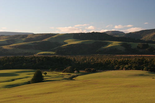
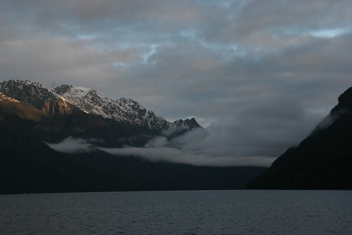
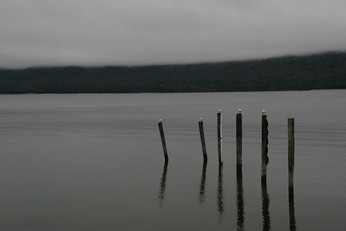
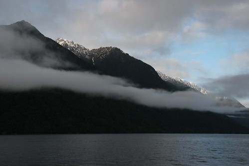
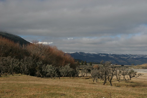
We leave the blue skies of Queenstown and drive along the shores of Lake Wakatipu to Glenorchy where the skies turn grey and low cloud has obscured the views. My guidebook says Glenorchy is set in stunningly beautiful surroundings but everything is suspended under mist.
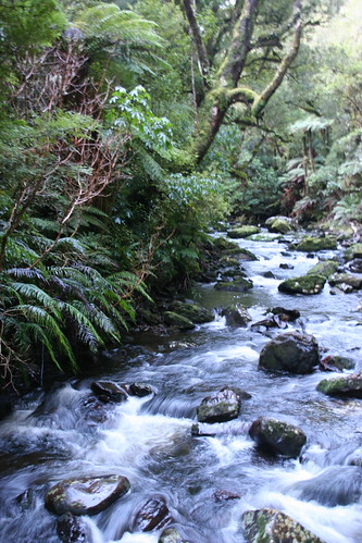
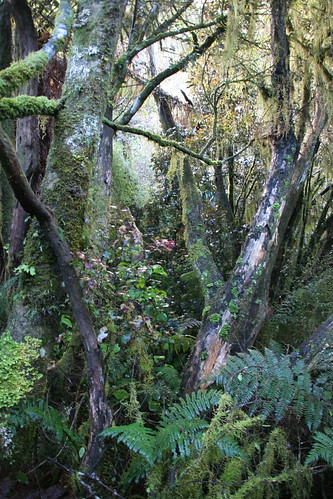
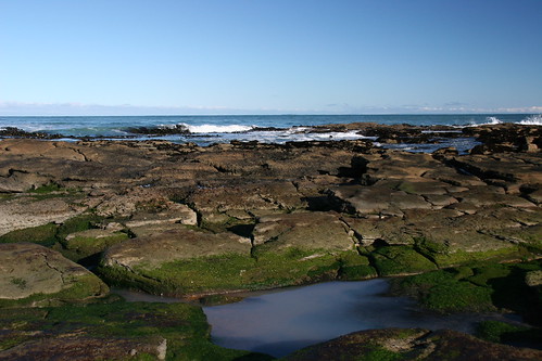
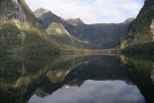
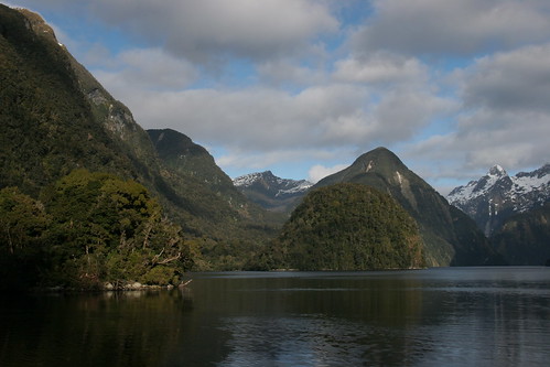
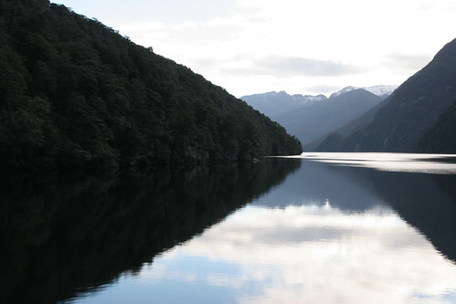
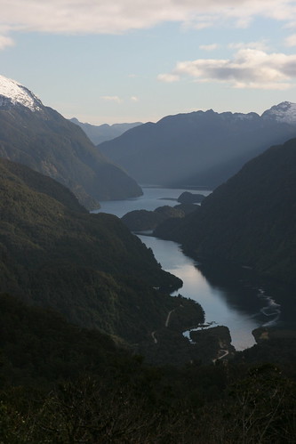
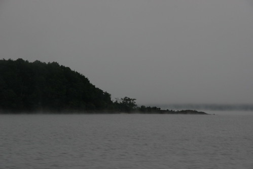
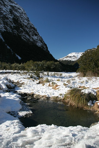
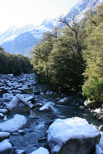
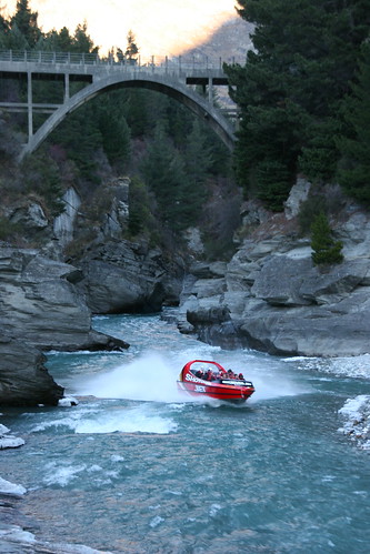
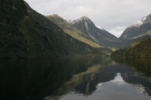
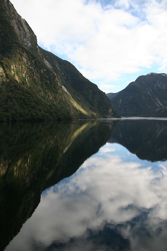
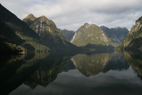
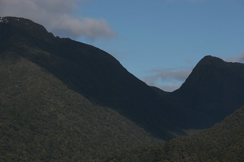
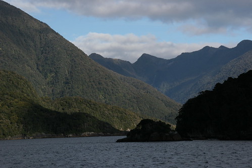
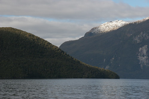
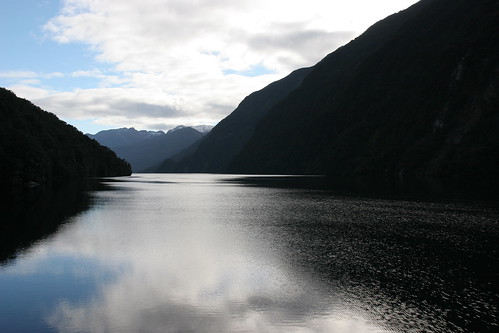
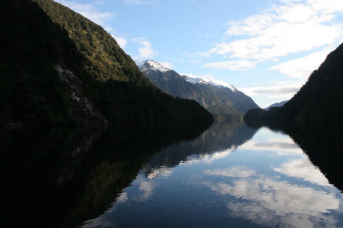
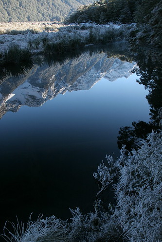
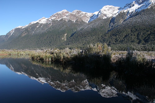
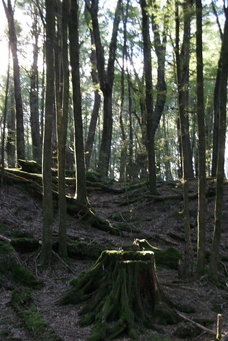
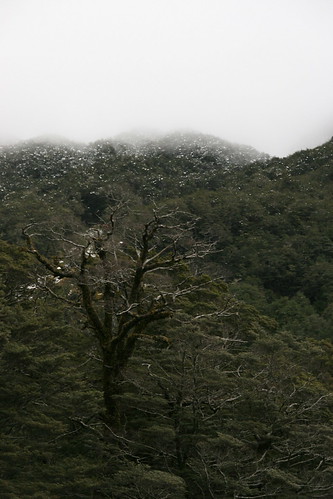
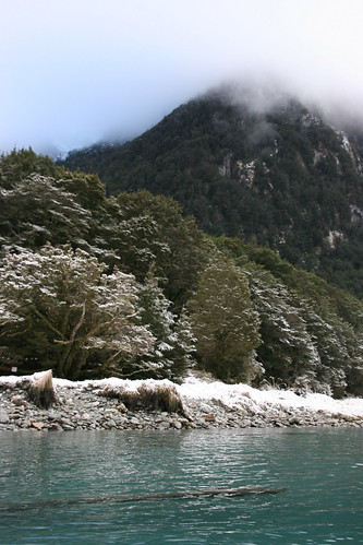
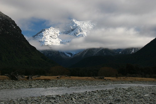
The first part of my journey is by jet boat down the wide, shallow Dart River. The scenery is spectacular - turquoise rivers, ancient beech forests and the snow-capped mountain ranges of Mount Aspiring National Park, crossing into Paradise, a place named after a New Zealand duck. We pass the start of the Routeburn Track, a hauntingly beautiful forested valley in between mountains and strangely enough the only place I can see that's not under cloud. I'd like to come back and walk the 4-day track one day. The area is famous as a Lord of the Rings location but I've grown to learn that nearly everywhere in New Zealand is a LotR film location. Peter Jackson pretty much had the whole country covered. This remote area (there are no towns, houses or people here and travel is only by boat up the river) has been the location for many films. Apparently this is the location for Isengard, Fengorn Forest and Lothlorien. Despite the magical landscapes, after an hour in the boat I'm shivering and relieved when we stop to take a walk in an ancient moss-covered forest.

(Photo - Start of the Routeburn Track along the Dart River)

Shotover Jet, Queenstown, New Zealand


Back in Queenstown I treat myself to a Fergburger, which I've become addicted to, before checking in for my afternoon adrenaline-charged activity. Someone on the plane from Los Angeles to Auckland recommended the Shotover Jet, a jet boat ride through a narrow gorge on the choppy Shotover River.

A ten-minute bus ride takes me to the Shotover River where we're given life jackets and raincoats. I'm looking forward to some thrills and spills on the turquoise rapids with 360 degree turns, but I'm disappointed. As an adrenaline rush it scores low on my list. I find the river and canyon draped with icicles more interesting. Back in Queenstown again I run into an old colleague from the BBC. What are the chances.

Thursday, July 26, 2007

Nevis Highwire Bungy, Queenstown, New Zealand


The rocks rush up towards me and then I feel I'm rising again. How many bounces is that? I've no idea. I pull the release cord (it works!) and I'm vertical again. Slowly I'm winched back up to the platform.

'How was that Maria?' the bungy master asks. I'd like to say something like 'awesome' but I'm in shock and can't speak. Five minutes later the adrenaline kicks in and I want to do it again. I'm exhausted though and my knees are trembling. I still have no recollection of the freefall.

Nevis Highwire Bungy, Queenstown, New Zealand


Soon I'm standing up and shuffling to the edge of the tiny platform with the bungy rope at my feet, which feels like a ball and chain. I cling to the bungy master's arm as there's nothing to hold on to and look straight ahead.

There's no time to think. '3-2-1 go' she says and my mind goes blank. I plummet down towards the rocks completely forgetting my James Bond-style leap. I remember nothing during the 8.5 second freefall. My mind is completely free.

Nevis Highwire Bungy, Queenstown, New Zealand


When it's my turn I climb into the cable car with five others to take me across to the pod. We're all attached to the car with carabinas. Inside the pod it's buzzing. Loud rock music and adrenaline-filled jumpers make it a deafening place. The pod sways slightly which unnerves some. There are also glass panels in the floor so you can see what you're jumping into.

I wait ten minutes before my name is called to have my bungy straps fitted. Soon I'm sitting in what looks like a dentists chair and attached to the bungy rope. The bungy master is an intimidating lady who tells me to leap and not just 'fall off' the platform. I must also pull the release cord to invert myself on the second or third bounce. It's already too much information.

'Smile' at the camera she says but my face looks like I'm being made to jump without a harness. When she's not looking I check to see if my harness is fitted securely, unbeknown to me that my DVD is already recording.

Nevis Highwire Bungy, Queenstown, New Zealand


The Nevis is a bit of an ordeal. After the 'check in' and the hanging around for half an hour there's a 45-minute bus ride out to the canyon where we jump. I'm quite happy sitting on the bus and don't want the journey to end but I know it's my nerves talking. As the bus climbs the last hill I hear 'oohs' from the other side of the bus. They must have seen the jumping pod. I carry on looking out of my window. I don't want to see.

As we're getting off the bus, the driver asks if we have any questions. I ask if I should leave my woolly hat on as it's rather cold. 'You can' he replies 'but it probably won't be coming back up with you'. It was a stupid question really. Inside the small office I'm weighed again and my weight is written on my hand. The heaviest people will jump first which is most of the boys, meaning I'll have an agonising wait before it's my turn. I look out over the canyon to see a small pod suspended over the Nevis River. My first thought is that it's not as high as I thought.

Nevis Highwire Bungy, Queenstown, New Zealand


I had weird dreams last night and am a bit stiff this morning from the rock climbing yesterday.

At the Bungy Centre I sign away my life on the indemnity form and tell them I have a slight problem with my neck. I didn't think it would be a problem but the girl behind the desk phones someone and then transfers me to the 'deck master' at the Nevis. He tells me I'll be fine as long as I leap out as far as I can for a smoother ride. If I just 'drop off' then I could suffer whiplash. Now I'm worried. I didn't know there was a technique involved in bungy jumping.

They weigh me and write some numbers and codes on a piece of paper. The girl at the desk asks me where I'm from for my certificate. It's already being printed and I haven't even jumped yet. I ask her if anyone ever turns back from the platform. 'No, she says but a few people have jumped off crying'. 'Has anyone been seriously injured? I ask. 'No but there's always a first' she replies laughing. I think she's in the wrong job.